соотношения площадей и периметров геологических тел
реклама
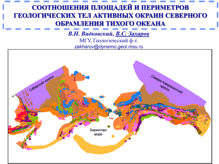
СООТНОШЕНИЯ ПЛОЩАДЕЙ И ПЕРИМЕТРОВ ГЕОЛОГИЧЕСКИХ ТЕЛ АКТИВНЫХ ОКРАИН СЕВЕРНОГО ОБРАМЛЕНИЯ ТИХОГО ОКЕАНА В.Н. Вадковский, В.С. Захаров МГУ, Геологический ф-т. zakharov@dynamo.geol.msu.ru Блоковая структура пирамиды Источники данных • Geographic Information System (GIS) Compilation of Geophysical, Geologic and Tectonic Data for Circum-North Pacific. USGS, Open-File Report 99422, Version 1.0, 1999, (CD). • Summary terrane, mineral deposit, and metallogenic belt maps of the Russian Far East, Alaska and Canadian Cordillera. USGS Open-File Report 98-136, 1998, (CD). • Dynamic Computer Model for the Metallogenesis and Tectonics of the Circum-North Pacific. Литература • Turсotte D.L. Fractals and chaos in geology and geophysics. Cambrige, 1997. • Горяинов П.М., Иванюк Г.Ю. Самоорганизация минеральных систем. М., ГЕОС, 2001. • Федер Е. Фракталы. М., Мир, 1991. • Мандельброт Б. Фрактальная геометрия природы. М., ИКИ, 2002. • Шредер М. Фракталы, хаос, степенные законы. Ижевск, 2001. Типы данных СВ России. Геологическая карта Аляска. Тектонические единицы СЗ Канады. Типы террейнов Некоторые определения Термин Определение Accretionary-wedge and subduction-zone terrane. Fragment of a mildly to intensely deformed complex consisting of varying amounts of turbidite deposits, continentalmargin rocks, oceanic crust and overlying units, and oceanic mantle… Collage of terranes Groups of tectonostratigraphic terranes, generally in oceanic areas, for which insufficient data exist to separate units. Cratonal terrane Fragment of a craton. Continental-margin arc terrane. Fragment of an igneous belt of coeval plutonic and volcanic rocks and associated sedimentary rocks thatformed above a subduction zone dipping beneath a continent. Inferred to possess a sialic basement. Island-arc terrane Fragment of an igneous belt of plutonic rocks, coeval volcanic rocks, and associated sedimentary rocks that formed above an oceanic subduction zone. Inferred to possess a simatic basement. Metamorphic terrane Fragment of a highly metamorphosed or deformed assemblage of sedimentary, volcanic, or plutonic rocks that cannot be assigned to a single tectonic environment because the original stratigraphy and structure are obscured. … Metamorphosed continental-margin terrane. Fragment of a passive continental margin, in places moderately to highly metamorphosed and deformed, that cannot be linked with certainty to the nearby craton margin. May be derived either from a nearby cratonal margin or from a distant site. Oceanic crust, seamount, and ophiolite terrane. Fragment of part or all of a suite of deep-marine sedimentary rocks, pillow basalt, gabbro, and ultramafic rocks (former eugeoclinal suite) that are interpreted as oceanic sedimentary and volcanic rocks and the upper mantle. … Passive-continentalmargin terrane. Fragment of a cratonal margin. Subterrane Fault-bounded unit within a terrane that exhibits a similar, but not identical, geologic history relative to another faultbounded unit in the same terrane. Superterrane An aggregate of terranes that is interpreted to share either a similar stratigraphic kindred or affinity, or a common geologic history after accretion (Moore, 1992). An approximate synonym is composite terrane (Plafker and Berg, 1994). Tectonostratigraphic terrane. A fault-bounded geologic entity or fragment that is characterized by a distinctive geologic history which differs markedly from that of adjacent terranes (Jones and others, 1983; Howell and others, 1985). Turbidite-basin terrane Fragment of a basin filled with deep-marine clastic deposits in either an orogenic forearc or backarc setting. May include continental-slope and continental-rise turbidite deposits, and submarine-fan turbidite deposits deposited on oceanic crust. May include minor epiclastic and volcaniclastic deposits. Распределения по размерам 7000 1800 С-В России 6000 1000 5000 С-В России 1600 Norm 1400 Норм. 4000 1000 1200 100 1000 100 800 3000 10 1000 0 1 0.1 1.0 10.0 600 Количество Количество 2000 200 0 1000 Аляска 4500 1 1 Площадь, 108 5000 10 400 10 Периметр, 10 900 4000 Норм. 1000 4 1000 Аляска 800 3500 700 3000 600 Norm 100 100 2500 500 2000 400 10 1000 500 0 Количество Количество 1500 1 0.1 1.0 200 100 0 10.0 1 0 8 10000 10 300 10000 Площадь, 10 С-З Канада 1 10 Периметр, 10 2000 С-З Канада 1800 8000 Норм. 4 1000 1600 1000 1400 6000 1200 100 1000 4000 800 0 1 0.1 1.0 Площадь, 10 Площадь 10.0 8 Количество Количество 10 2000 10 600 400 200 0 0.1 1.0 10.0 Периметер, 10 Периметр 4 С-В России d=1.37 Соотношения площади (S) и периметра (P): S ~ P 2/d или log(S) = 2/d log(P) + A d - фрактальная размерность Аляска d=1.20 С-З Канада d=1.24 Соотношения площади (S) и периметра (P) для различных типов террейнов СЗ Канады 1.25 Все 1.4 1.36 1.32 1.24 6000 1.18 5000 4000 1.1 3000 D 2000 N 1000 1.0 0 N 1.31 Overlap Assemblage 1.20 Craton 1.16 1.19 Post-Terrane Accretion Plutons 1.29 Island Arc 1.3 Displaced Continental Margin 1.2 Pericratonic Margin Sequence Metamorphic Assemblages 1.37 Accretionary Wedge / Subduction Complex / Ocean Crust Accretionary Wedge Oceanic Marginal Basin Фрактальная размерность d Фрактальная размерность различных типов террейнов СЗ Канады 10000 9000 8000 7000 1.4 1.36 1.27 1.28 1.23 1.24 1.17 1.1 5000 4000 D 3000 N 2000 1000 1.0 0 N 1.3 Все 1.18 sedimentary plutonic volcanic/sedimentary 1.21 1.24 volcanic 1.2 sedimentary/volcanic/metamorphic 1.24 sedimentary/volcanic metamorphic sedimentary/metamorphic ultramafic/volcanic/sedimentary Фрактальная размерность d Фрактальная размерность террейнов СЗ Канады (по типам пород) 10000 9000 8000 7000 6000 Соотношения площади (S) и периметра (P) для террейнов различного возраста С-В России Зависимость фрактальной размерности от возраста для множества террейнов с.- в. России 2.0 5000 1.8 5000 1.8 1.4 1.2 3000 1.0 0.8 2000 d 0.6 N 0.4 1000 0.2 1.6 4000 1.4 1.2 3000 1.0 0.8 2000 d 0.6 N 0.4 1000 0.2 0.0 0 100 200 300 400 Время, млн.лет 500 0 600 0.0 0 100 200 300 400 Время, млн.лет 500 0 600 Количество N 4000 Фрактальная размерность d 1.6 Фрактальная размерность d Аляски 2.0 Зависимость площадь-периметр в двойном логарифмическом масштабе для современных континентов и крупных островов. Евразия и Африка С. и Ю. Америка d = 1.22 Антарктида Гренландия Австралия Распределение эпицентров землетрясений Сибирь Линии – границы блоков по Скотизу и др. , стрелки – вектора скорости по данным GPS., 2001. Аляска Берингово море Сибирь Аляска Берингово море
